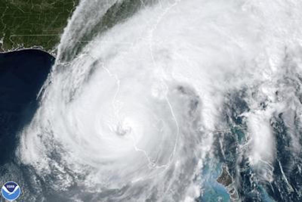
Category 4 Hurricane Ian made history, placing itself as the fifth strongest hurricane to hit the United States.
On September 26, just two days before landfall, the National Oceanic and Atmospheric Administration, specifically the NWS National Hurricane Center Miami FL, released a statement warning the Gulf of Mexico, Florida, Georgia and South Carolina that a powerful Hurricane was going to strike and the track of the storm.
“An even greater concern is the slower forward motion that is forecast during this period, as the upper trough passes north and east of Ian and the steering currents weaken. This would likely prolong the storm surge, wind, and rainfall impacts along the affected portions of the west coast of Florida,” the report stated.
According to the NOAA, a “storm surge” means that there will be life-threatening flooding and rising water moving inland over 48 hours.
“It developed, it had this track where it went northward over Cuba first before Florida,” Reed said. “It went back over the Gulf of Mexico and it was able to develop further because the waters are even warmer there this time of year.”
Florida officials urged Floridians to evacuate their homes due to the increasing concerns over the storm. On September 27, Ian became a Category 3 hurricane threatening the coast, and Florida Governor Ron DeSantis issued an evacuation order for 12 counties in the state.
“When we went to bed Monday night, people were saying this is a direct hit on Tampa Bay, the worst-case scenario for the state,” Governor DeSantis said. “As that track started to shift south, and the computer models the next morning, they called for the evacuation, they opened their shelters and they responded very quickly to the data.”
After destroying Florida, Ian was predicted to head into the Atlantic, instead, the storm moved up the East Coast. Officials in the Carolinas and Georgia issued warnings urging people to evacuate.
“Those well defined eyes we see on the satellite image oftentimes those dissipate when they interact with an island [Cuba],” Reed added. “But in the case of Ian, it didn’t. It was strong that it was able to keep its organizational structure which made it really right for when it was back over the ocean to kind of rapidly intensify into a category 4 storm before it made land.”
Ian made landfall in Florida on September 30.
“Nothing from the forecast perspective was a surprise,” Reed said. “This was well forecasted. It was forecasted that it was likely to be a major storm when it made landfall.”
At least 100 people in Florida and 5 people in North Carolina have been reported dead.
“I’ve lived in Florida a long time and wasn’t as fearful for other hurricanes as I was for Ian,” Valerie Swimline, 60, of Manatee County told The Messenger. “We got luckier than Tampa and other places down here. Going to take a lot of time for towns down here to recover after this.”
Ian destroyed thousands of homes, boats and even causeways.
The Sanibel causeway was left partially collapsed after feeling Ian’s wrath. The causeway connected the island with the Florida mainland in Punta Rassa.

“We are luckier than most at this time, only lost power and minimal damage,” Jennifer Brandon, 31, of Manatee County told The Messenger. “I will continue to keep the rest of the south in my prayers as I haven’t witness a storm this bad in a long time.”
The Federal Emergency Management Agency (FEMA) is sending relief to Florida to help rebuild after the catastrophic event.
Vice President Kamala Harris says economic relief will be sent out to those affected by the storm, based on equity.
“It is our lowest-income communities and our communities of color that are most impacted by these extreme conditions,” Harris said. “We have to address this in a way that is about giving resources based on equity, understanding that we fight for equality, but we also need to fight for equity.”
The Messenger laments for those impacted by Hurricane Ian.


